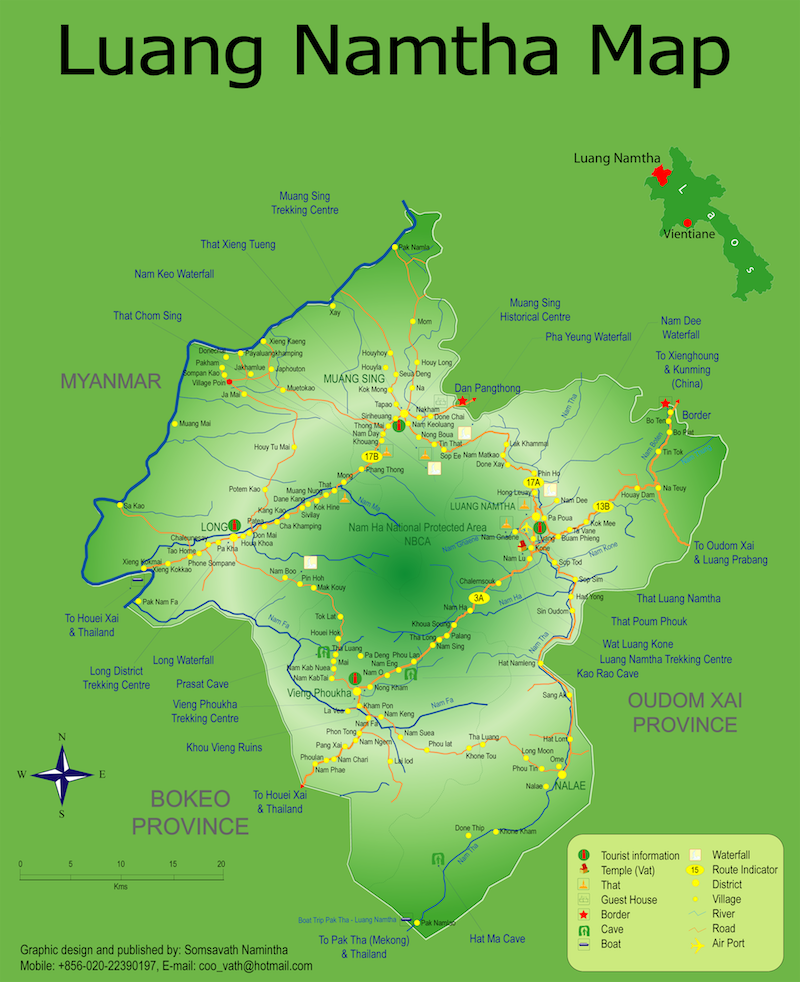
Luang Namtha Province is tucked into the north-western corner of Lao PDR. It covers an area of 9,325 square kilometers, with 85% of that terrain being low calciferous mountains, rising between 800-2,000 meters.
Weather, like the rest of the country, is characterized by a rainy season from May to September, a cool dry period from October to February, and March, April are the hottest months. On average daily temperature is a please 25 degrees celsiu, but during the cool season it can dip to zero on the coldest nights.
To the north Luang Namtha shares a 140 kilometer land border with China, and it’s northwest frontier follows a 130 kilometer strech of the Mekong River.
The province is divided into 5 districts, Luang Namtha includes the capital and environs, and is the gateway to travels in the province. Muang Sing, Muang Long are located to the north-west of the capital, Vieng Phouka to the south-west, and Nalae in the south.


 Users Today : 189
 This Month : 1470
 This Year : 1470
 Total Users : 47198
 Views Today : 404
 Who's Online : 4